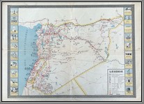
Middle East
 MP 517Tayyare Merakizini Gösterir. Şimal-i Afrika: ...[1922'de] Takriben 225 bin yolcu nakil edilmiştir. Çalışan tayyare miktarı da tahminen 1000... Almanya: 1922'de, 7730 yolcu ve 65370 kilo mektup ve posta paketi nakil edilmiştir… Fransa: 1922'de 14397 yolcu 52962 ton emtia ve 41173 kilo posta nakil edilmiştir. “Shows Aircraft Centers. North Africa: ...[in 1922] Approximately 225 thousand passengers were transported. The number of aircraft working is estimated at 1000. Germany: In 1922, 7730 passengers and 65370 kilos of letters and postal parcels were transported. France: In 1922, 14397 passengers, 52962 tons of commodities and 41173 kilos of mail were transported.”Size: 40x19cm. M
Price: $220.00
İstanbul Civarı, Kağıthane ve Ali Bey Vadilerinin Harita-i İstikşafiyesidir / Erkan-ı Harbiye Komisyonu (Fehmi Bey) tarafından yapılmıştır. “It is the Map-i İstikşafiye (exploratory) (of the Kagithane and Ali Bey Valleys around Istanbul / It was made by the Erkan-ı Harbiye Commission (Fehmi Bey).”c1925. Size: 57x82cm. M
Price: $800.00
Karte vom Turkischen Kriegsschauplatz. Map of the (World War 1) Turkish Theatre of War. Shows main battles, with insets of Arabia and the Dardanelles. Appears to be a childs game with small flags in the margins representing each country fighting, which you would cut out and place on the map as the war evolved. Size: 54x81cm. Repaired with acid-free tape. Rare.B
Price: $1200.00
Map showing the formation of the various Kingdoms governing Palestine in the Middle Ages: Formation Territoriale du Royauame de Jerusalem, Seigneurie D’Outre-Jordain, Formation Territorale du Comte de Tripoli, Principaute d’Antioche, Le Comte d’Edesse. Edmond Paillard, cartographe. Size: 45x55cm. Repaired. B
Price: $150.00


