Africa

mp557MP 557


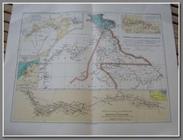
1905 map of Nigeria, Cameroun, French Congo and the projected railway from Dire Dawa to Addis Abbeba by M. Chesneau. Size 38x48cm (with margins).

Price: $150.00

mp551MP 551


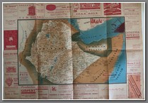
Map of Abyssinia produced by an advertising consortium in Barcelona during the Italian invasion in 1935. Reverse shows a map of Mediterranean with focus on Italy. 50x70cm. B

Price: $390.00

mp550MP 550


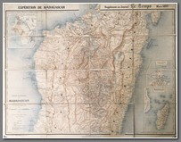
Expedition de Madagascar. Supplement au Journal Le Temps, March 1895. Scale 1:1,000,000. 74x94cm. cloth backed. B

Price: $1200.00

mp549MP 549


Carta Topografica di Masaua e Sue Adiacenze – Panorama del Teatro della Guerra. Rare colorful map produced around 1890. First map I have seen of conflicts before 1896 war. 68x82cm. B

Price: $1200.00

mp548MP 548


Les Colonies des Etats Europeens en Afrique, May, 1918. Edite par L Science et la Vie. Shows interesting comparisons in terms of populations and areas. 46x59cm. B

Price: $300.00

mp546MP 546


Veduta Panoramica Dell’ Africa Orientale. 70x99cm. Rare. B

Price: $900.00

mp545MP 545


1973 map of Rhodesia, with city inserts for the central areas of Umtali, Gwelo, Bulawayo and Salisbury. 37x41cm. B

Price: $150.00

mp539MP 539mp539aMP 539


Carte du Transvaal et des regions limitrophes de l’Afrique Australe. Librairei Hachette et Cie, 1900. Size 63x44cm. One of the mor comprehensive maps of the region at the onset of the Boer War. Text on reverse aand original cover included. B

Price: $500.00

mp538MP 538


Carte D’Afrique pour server a l’intellignece de L. Abrege de L’Histoire Generale des Voyages par La Harpe, Paris, 1830. Size 44x38cm. B

Price: $300.00

mp526MP 526


Carta Storico – Politica Dell’Africa Orientale. Scale 1:2500000. Size 87x120cm. Much detail. Cover included.

Price: $450.00

t-tro072TRO 072


Map of Africa from Yeni Coğrafya Atlası: (Çeviren: Ali Şeref Paşa - Muhiddin). İstanbul 1307 - 1310(hicri) / 1309 - 1312(rumi) 1892 - 1894(miladi) Matbaa-i Âmire. “New Atlas of Geography: (Translated by Ali Şeref Pasha - Muhiddin). Istanbul 1307 - 1310(hijri) / 1309 - 1312(rumi) 1892 - 1894(Gregorian) Matbaa-i Âmire. Size: 52x41cm. M

Price: $390.00

mp496MP 496


Tabula Universalis Lcorum, quae Phoenicum Navigationibus Maxime frequentata Sunt, A Taprobana Thulen usque. 15-16th century map, with what appears to be Hebrew subtext. 38x46cm. B

Price: $560.00

mp475MP 475mp475aMP 475


1971 National Geographic map of The Peoples of Africa. Reverse shows The Heritage of Africa. Measures 58x71cm. M

Price: $60.00

mp445MP 445mp445aMP 445


Plan of Santa Isabel - Fernando Poo - 1946 Size: 120x76cm. CURRENTLY UNAVAILABLE

Price: $600.00

mp427MP 427


El Impreio que Alemania Ha Perdido en Africa. Original Spanish propaganda map showing what Germany lost in Africa in World War 1. 6x43cm. M

Price: $390.00

mp422MP 422


Colonie dell’Africa orientale Italiana E Abissinia. Size: 50 x 70cm. m

Price: $390.00

Copyright © 2013-2024 History Revealed